VICKSBURG, Miss. (Feb. 14, 2020) — As the installation asset mapping project nears completion, the U.S. Army Engineer Research and Development Center’s Unmanned Aircraft Systems Program Manager Jenny Laird said she feels proud of her team.
“This has been a two-year project in the making, and it’s a huge accomplishment for our group, the Environmental Laboratory and the ERDC as a whole to have created a comprehensive map for a 700-acre installation,” Laird said. “That’s a large data collection to take on as our first go-around with this type of application.”
The project was initiated at the request of ERDC’s Department of Public Works, along with the Installation Support Division, to capture a full Geographic Information System data set that will be the basis of an updated installation map. Anyone performing work on the 700 acres will have the most precise information available about contour lines, elevations, facilities, utilities, buildings and the location of water and electrical lines.
Laird and her UAS team have conducted numerous geophysical data collections and have utilized UAS for coastal monitoring applications, assessing plant health, identifying cracks in airfield pavements and other aerial applications. Using UAS to map installation assets was a new application for the group.
“I think one of the reasons the ERDC UAS team has grown into such an asset is because our team is made up of professionals who have a variety of backgrounds, including GIS, wildlife biology, forestry, remote sensing and other areas of expertise.” Laird said. “Through this unique mix of capabilities, we can accept a diverse range of projects and innovate using our varied knowledge and past research experience.”
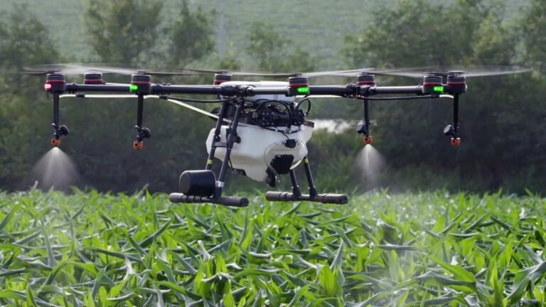
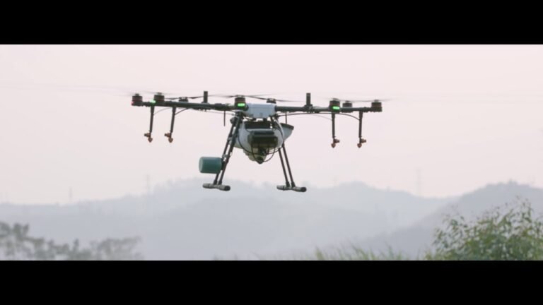
In this particular project, the team first used a vertical take-off and lift UAS (BirdsEyeView FireFly 6Pro S), which was mounted with a red, green, blue 35 megapixel camera to collect detailed orthomosaics, or aerial photographs georectified for map scale. The team took twenty thousand images and stitched them together, producing an up-to-the-minute map of installation infrastructure.
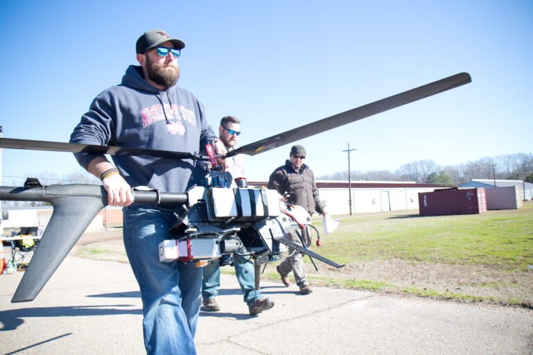
In the second phase of the project, the team utilized their 54.5-pound, six-foot-long helicopter UAS (Pulse AeroSpace Vapor 55), and attached both a light detection and ranging (Reigel mini-Vux) sensor and a 42MP RGB camera to obtain data.
“The beauty of this data is that it’s very accurate, and you can start doing volumetric measurements,” said Shea Hammond, wildlife biologist, lead pilot and developer for the team. “If DPW needs to start moving dirt from one place to another, they can calculate how many truckloads they’ll need to fill in an area from this data. They can see the bare-earth models and know exactly what the inclines are.
“If a biologist wants to know tree density in an area, then that can also be calculated with this type of data. You can map aspects of volume that you can’t typically do with a standard camera. You can penetrate vegetation and see not only the ground but above the ground.”
Hammond has advanced degrees in biological science and previous experience with geospatial data. “What I saw with UAS was the ability to collect those data at a much higher spatial resolution,” he said.
After pursuing continuing education, where he learned how to build, fly, repair and maintain UAS systems, Hammond obtained Federal Aviation Administration certifications along with all other members of the U.S. Army Corps of Engineers Aviation program.
“Most folks say to me, ‘hey, flying UAS, that’s an awesome job,’ and I agree, it is, but you also have to realize there is a 55-pound aircraft that you’re putting in the air, and it costs the Corps a quarter million dollars, and we only have one shot to complete a mission, so there is a lot of responsibility and pressure,” he said. “We train hard, so we can perform under that pressure.”
Hammond feels it’s a continuous process to better the entire team. He ensures that everyone is trained on the equipment on a quarterly basis, with most of the training geared toward safety. Other responsibilities that Hammond oversees include ensuring that the appropriate notifications are provided before the team flies, that the necessary precautions have been taken, and that flight plans have been prepared.
“I do enjoy working with UAS; it’s something different every day,” said Kenneth Matheson, a geodetic technician and UAS pilot. “As a team we work together well, we communicate well, and we help each other out; if there is something that needs to get done, we just switch up and do it.”
“We do pretty interesting and cutting-edge things⸺not many people cover 700 acres with UAS using both a RGB camera and LiDAR,” he said.
“UAS in general is an emerging field, and ERDC wants to sit on that edge of emerging fields and inform the rest of the Corps,” Hammond said. “By utilizing some of this equipment, going through some of the hard knocks, hopefully that prevents the rest of the Corps and our customers from having to go through the same, and we can inform USACE Headquarters Aviation and others what equipment to use, what the most efficient means is of processing the data, how to maintain equipment and how to incorporate safer practices.”
Laird predicts UAS will be heavily, if not exclusively, used in the future for doing surveys or other types of mapping. She also believes the technology will be used more frequently in emergency response, to give first responders a bird’s eye view of locations, instead of putting people in harm’s way.
“The unique thing about ERDC is that we have experts here who can create algorithms to find the cracks along infrastructure, so we can use a UAS to identify all the cracks along a lock, a dam or a bridge and do it a lot more efficiently and safely than we used to,” she said.
The team is hoping to have the final products and all the data from the current mapping project to DPW by the end of March. DPW can then incorporate it into the BUILDER™ program and use it to fulfill other data requirements.
